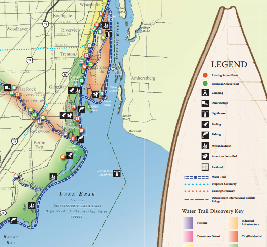
New Detroit Water Trail Map Charts 32 Miles of Paddling
The Detroit Heritage River Water Trail guide maps kayak launches, campsites, and paddle routes in Southeast Michigan.


Paddlers hitting Metro Detroit’s river system will have a new guide: a water trail map. The Metropolitan Affairs Coalition has created a water trail map covering 32 miles of the Detroit River and its tributaries—the Rouge River, Huron River and River Raisin. Guide Project Manager Susan Phillips says the water system and its shoreline are continuing to evolve.
“We did the first map a few years ago and we’ve seen so much progress that we thought it was time to move from what was a vision at that time to actually something that is a user or trail guide that people can use to help plan their outdoor adventures on our waterways.”
-Susan Phillips
Phillips says that includes two kayak launches, which are set to be installed on Belle Isle by the end of the year.
