CuriosiD: That Waterway in Detroit, Is it a Strait or a River?
Sandra Svoboda July 25, 2017It takes a team of historians and geographers to answer this listener’s question.
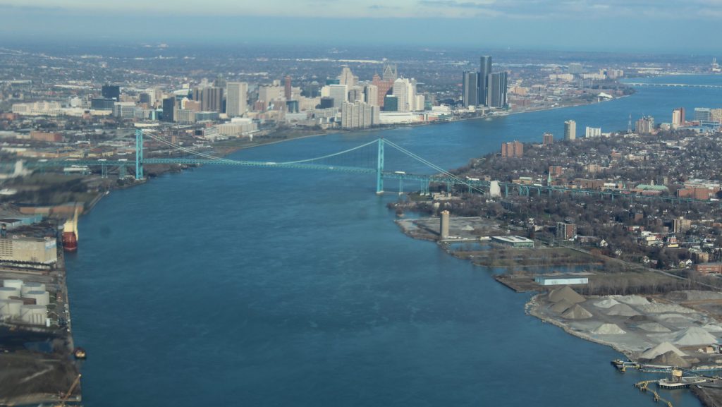
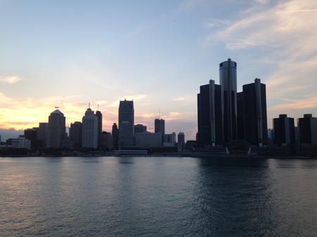
An aerial view of the Detroit River.
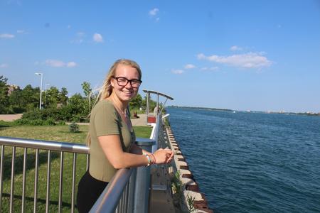
Listener Bailey Townsend submitted this question to CuriosiD:
“Why is the Detroit River called ‘Detroit River’ when it’s actually a Strait?”
THE SHORT ANSWER
First, let’s clarify what the waterway is: river or strait?
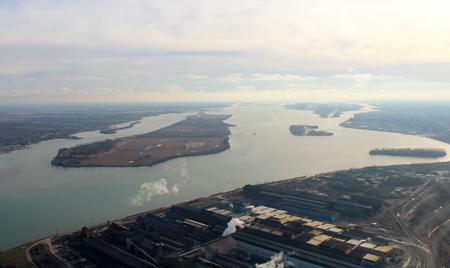
“It’s both,” says Alan Arbogast, professor and chairperson of the department of geography, environment, and spatial sciences at Michigan State University. “It’s probably one of the few places on earth where the term applies so well for both.”
Next, let’s answer the “why” part of Bailey’s question:
A conclusive, specific explanation is lost to history, says Brian Dunnigan, associate director and curator of maps at William L. Clements Library at the University of Michigan. He would be one to know. Dunnigan collected the oldest surviving maps and drawings of the area from archives and collections in France, Canada, and the United States and published them in his landmark book, “Frontier Metropolis: Picturing Early Detroit, 1701-1838.”
The French, when they arrived in the Great Lakes area, did call the waterway “Détroit Erié ’” or “Strait of Erie,” an accurate geographic label as a “strait” is defined as a connector between two large bodies of water. But beginning in the 1740s, it’s labeled “Rivière du Détroit” or “River of the Straits.” When the English gained control of the region, they changed the pronunciation, and continued calling the flowing waterway a river.
So the current name accurately reflects both terms and the area’s French-British heritage.
The 300-Year Story:
For hundreds of years, Native Americans lived along what is now called the Detroit River. The French started the straits-river confusion, and to fully understand it requires a 300-year look into history, a little bit of geography, and a linguistic twist.
Start with Antoine de la Mothe Cadillac, who landed on a sandy beach in 1701 and established Fort Pontchartrain, the first permanent settlement in the area that is now Detroit.
“Cadillac envisioned that (the French) could have a settlement that would keep the British and their Indian allies out of the Great Lakes area so that the French could control the fur trade, which was making them a lot of money,” says Lynda Litogot, who teaches a Michigan history course at Wayne State University.

Between 1689 and about 1763, France and Great Britain fought four wars as each was “struggling to be the world’s supreme country,” Litogot says. Great Britain, along with Native American allies, prevailed, and the Great Lakes region became British, according to the dominance of the European powers.
“The French lose control of the whole Great Lakes area. So they’re gone when the British take control,” Litogot says.
While the conflicts were happening, the French continued to map the region. Dunnigan’s book provides reproductions of several of them. And that’s where the straits-to-river transition happens, at least in the existing historical record.
MAPPING NAMES

According to Dunnigan’s book, the oldest existing map specifically showing the French settlement that became Detroit is a 1702 drawing – possibly by Cadillac – showing Fort Pontchartrain, some temporary Native American villages, and a bison hunt near what is now Toledo. But it doesn’t have a name on its depiction of the river.

The first map to name the waterway is from 1734, where it was labeled “Détroit Erié’” or the “Straits of Erie.” In French, “détroit” means “straits” and Erie is the lake to the south.
But, Dunnigan says, the labels changed within about a decade.
“The use of the word ‘strait’ in the name seems to disappear in about the 1740s when the French maps in the last 10 years or so of French occupation, start to refer to refer to it as the ‘Rivière of Détroit’ or the ‘Detroit River,’” he says.
But he doesn’t know exactly why the name went from strait to river.
“As far as I can tell you from the official documents that I read. It doesn’t seem to have been official, like an order from Quebec that you started calling it the Detroit River,” Dunnigan says.
He thinks as more British troops were in this area and eventually controlled it, they changed the pronunciation from the French “deh-twah” to the English “dee-troyt” that we use today. So they needed the river moniker to complete the translation.
“The English refer to it usually — in fact almost always — as the Detroit River and their maps use that term almost completely,” Dunnigan says.
Historian Litogot says the Anglicization of the terms represents the tense relationship between the then-world powers. “It also just signifies the enormous change that was made,” she says. “There were many people who added to the heritage of Detroit.”
MORE CONFUSION

For the geographer, Arbogast, what visitors experience at the downtown Detroit-Windsor waterway cause them to consider it one way.
“At a local level, it feels more like a river. When you’re by the Ren Cen, or you’re walking along the stream there, it looks and feels like a river, you can see the other side easily. In that sense, people think of it as a river,” Arbogast says.

Familiarity with the Straits of Mackinac could add to the confusion. At five- to six-miles wide, the connecting passage between Lakes Michigan and Huron are a reference for considering whether the Detroit River is a river or a strait. Since the Detroit River is so much narrower than the northern Michigan passage, opinions tend toward river, Arbogast says.
This strait-named-a-river situation isn’t unique. Dunnigan points out that the St. Marys River connecting Lake Superior and Lake Huron as well as the Niagara River flowing between Lakes Erie and Ontario are also, technically, straits.
“It might be that a fast-flowing, narrow body of water is usually perceived as a river,” he says.
DEH-TWAH, DEE-TROYT
Enter “detroit” in Google Translate – going from French to English – and the term is “strait.”

But break it up to “de troit” and google tells means “narrow.”


Beware the automatic translation, says Anne Duggan, professor of French and chair of classical and modern languages, literatures, and cultures at Wayne State University.
“One important lesson is that Google translate does not always translate well. It’s catching the connection between narrow, and étroit is a word you can use to refer to many different kinds of narrow things — a narrow space, a narrow picture — whereas Detroit is specifically a geographical term,” Duggan says.
When she looks at the early maps of the area, she thinks there’s a linguistic explanation for why the waterway’s designation changed from “strait” to “river.”
“The French are calling it later, le rivière du détroit. They’re not calling it Detroit as in the city, they’re calling it the river of the strait: Du Détroit,” she says. “Now you might refer to it le rivière de Détroit, the river of the city of Détroit.”
So one translation of the waterway’s name is the Straits River. Which reflects both geographic terms.
SO DOES IT MATTER WHAT IT’S CALLED?

Admiralty attorney Gary Baun has wondered about the river-strait designation in the course of his legal work. Based in Birmingham, he represents injured freighter crew and maritime workers around the world. One of his better known cases was on the Detroit River: the 2001 capsizing of the J.W. Westcott II. As the mail boat approached a freighter, it filled with water from the ship’s wake, and two people died. Their families hired Baun to represent them.
Baun says he researched whether the straits or river designation would matter in the context of the case. He found the legal grounding in a geographic designation from the federal government. “It was determined that the Detroit River was part of a restricted waterway plan through an act of Congress that was enacted by President Dwight D. Eisenhower,” he says. That federal law – the Great Lakes Pilotage Act of 1960 – applies to both types of waterways.
And Baun answered his own question about what the waterway is: both a river and a straits.
“That’s when that was really put to bed,” he says. “In the end, it didn’t really matter.”
MEET THE LISTENER

Bailey Townsend just graduated from Bloomfield Hills High School and is headed to Grand Valley State University to major in nursing and American Sign Language.
Along with her family, she visits the riverfront a couple times a month and she’s wondered about its designation as a river because she leans toward the “strait” categorization.
Her favorite part of exploring the answer to her question?
“I think it’s really cool that you can see the influence that the French have on this area still,” she says.
WDET’s CuriosiD is sponsored by the Michigan Science Center.

